![]() |
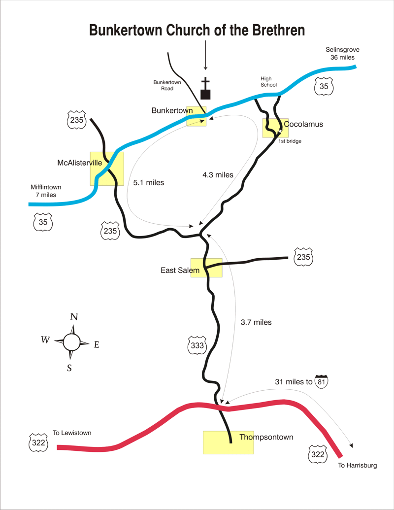
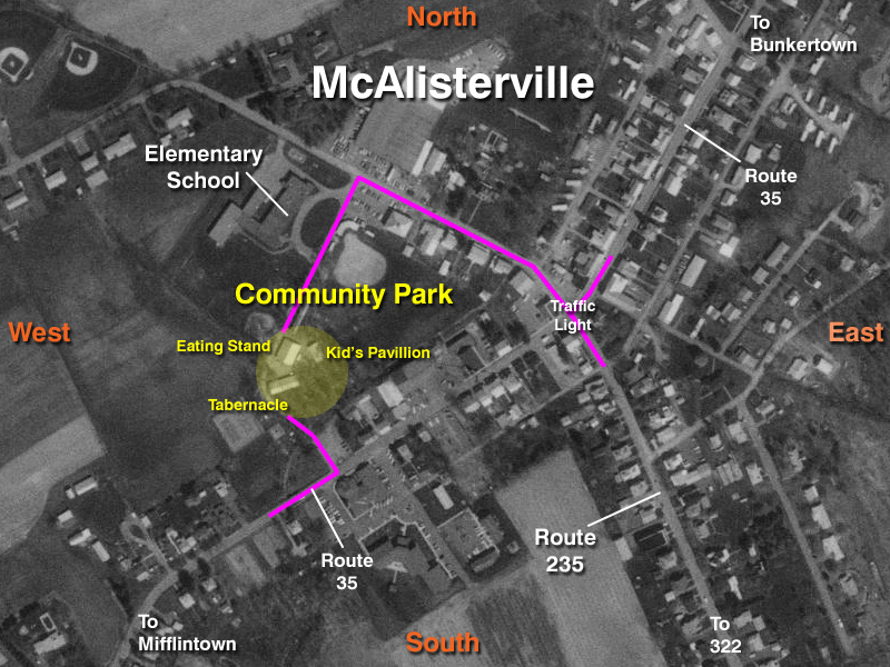
Directions McAlisterville Community Park is located in the town of McAlisterville in Juniata County in the central part of the state of Pennsylvania. If you have a GPS enabled device, point yourself to the following coordinates. Otherwise, please continue to follow our detailed instructions:
Latitude: 40.64 North
Longitude: 77.28 West From the South: Highlighted Map
Travel west on Route 322 and exit at Thompsontown (31 miles from Interstate 81). Turn right on Route 333 which soon becomes Route 235, and follow the signs to McAlisterville. Go through the traffic light crossing Route 35. Take the first left after the ball field and before the elementary school.
From the West: Highlighted Map
Navigate east toward Juniata County. Transfer to north Route 35. McAlisterville is about seven (7) miles from the Route 322 interchange. Turn left at the Lutheran Church (on right) or continue to the traffic light for a left turn and then another left immediately after the ball field.
From the East: Highlighted Map
Navigate west toward Juniata County. Transfer to south Route 35 which begins at Routes 11 & 15. McAlisterville is about another twenty-four (24) miles. Turn right at the McAlisterville traffic light and then left after the ball field.
The Bunkertown Church of the Brethren has this neat Local Map of the area, just in case you're more of a visual person who appreciates lines and colors. They're about two miles northeast of us on Route 35. Satellite Maps are intriguing for some and confusing to others. Hopefully you can figure out this lofty view of downtown McAlisterville. |
|
Home
About Us
God's Love
Photo Gallery
Contact Us
© Copyright 2008 - Fun Night - All Rights Reserved Designed and maintained by Ronald Gordon |
||